The earthquake hit on September 29, 2009, just over a year ago. It ran to 8.3 Richter scale, just 120 miles across the ocean from American Samoa. No time for warnings. Most people were just awakening. They had no warning, and little time. The tsunami came as suddenly as it was unanticipated. Funny and true story - the wave hit the local radio station as it was broadcasting the message "There is no tsunami" - shouts, then radio silence. It slammed ashore around 7:00 a.m. as children were going to school, parents to work. Small to medium size villages line the coast here, usually set in coves and small bays. These are beautiful, but they also magnify the force of the waves as they rush in toward shore. The water was unstoppable. Villages up and down the coast were devastated. Among the worst places to be were my village, Leone - it is on a larger than usual bay – and Pago Pago, at the narrow end of the superb Pago Pago Harbor. But some small villages were virtually wiped out.
Everyone here remembers just where they were, and what they did, when the tsunami came ashore. Ruth, my Chief PD, thought first of the family, and that included Steph and the other American lawyers here at the time. She called to warn, and went to get them. Her husband Junior operates heavy equipment for his living. He rushed to get a loader, drove it to Leone, and started to search for the injured and help the survivors. No one knew if another wave was coming in. There were three or four in all; but he didn't give a thought to that. Junior helped some people, and found some who were beyond help. He doesn't talk about that now. But the first thing he told us newcomers was to have a plan, know where to go, immediately if a warning sounded. He made sure we knew what to do if ever it happens again. Tua, one of our investigators, had two young children on a school bus at the time. It was driving along the oceanfront, the beautiful drive I commute upon and wrote about. The driver saved his kids; as soon as he saw the water go down and way out, he knew what would come. He turned the bus into a small village, and drove it as high up the mountain as it could go, road be damned. All his charges were safe, but by only a small margin. Stories like these are told by everyone here.
American Samoa lost 34 people known dead; likely several more as well who were undocumented, carried out to sea. Western Samoa, mainly Upolu, was hit as bad and lost over 100 people. Other islands in this corner of the Pacific also were struck.
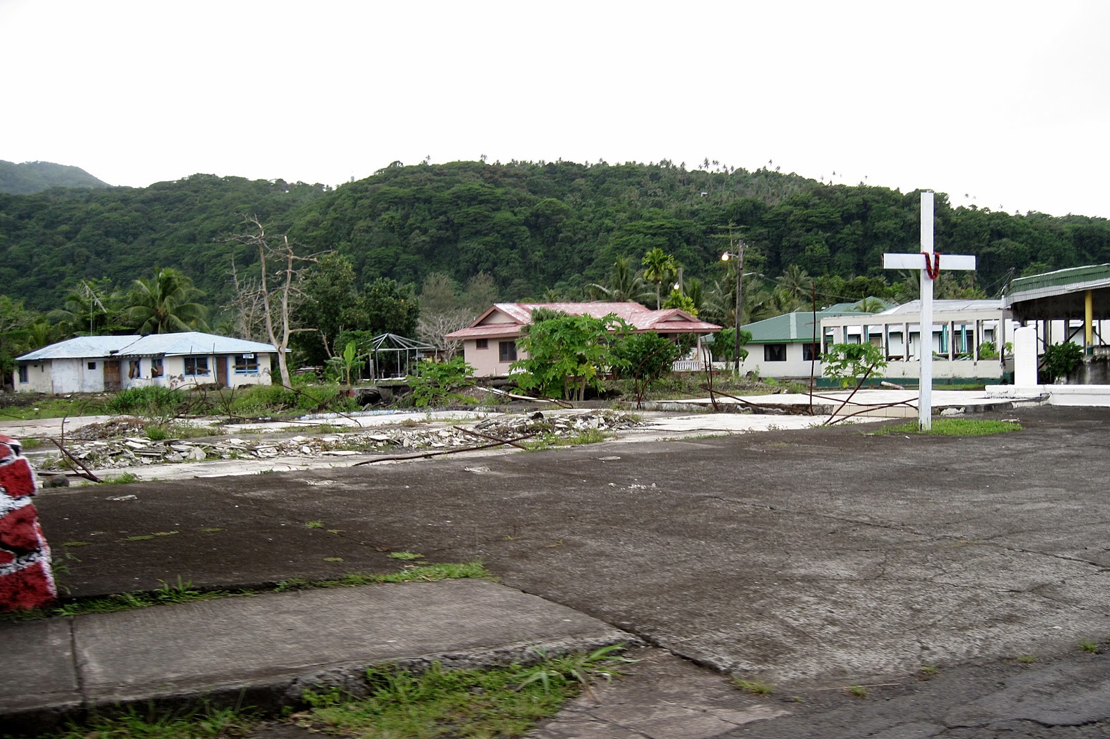
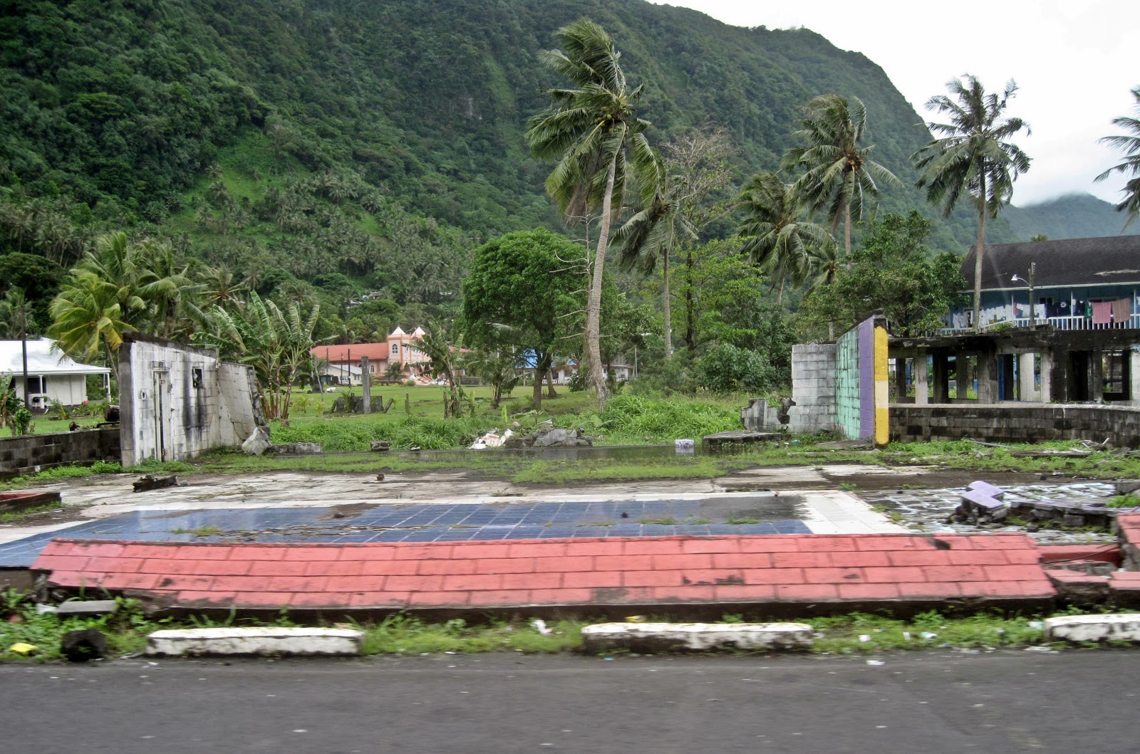
I don't have “before” photos; imagination will have to suffice. Here are some pictures of Leone and its vicinity now. The damage is obvious and continuing:
 |
| Shore, damaged houses, Leone bay |
 |
| Remains of home on shoreline, Leone. |
 |
| Leone scene, ominous cross. |
 |
| Leone, damaged family fale |
 |
| Bridge in Leone, washed out completely, now somewhat rebuilt. |
I found some videos of the immediate aftermath on YouTube. Here are some links. Note that the bridge washed out in Leone is in one of my photos; it was still temporary when I arrived, and just got somewhat fixed last week; still not a permanent fix. Also the post office, and some of the concrete pads where houses used to be are shown in the videos:
Leone longer video, mainly interviews:
I have a couple photos of small villages west of Leone. A small village named Poloa is on the northern shore, past Leone. It was wiped out, as seen in the YouTube video link below. My photos are of buildings up the hill, probably 15 feet above the sea level, also heavily damaged:
 |
| Poloa home - remnants, anyway |
 |
| Another devastated Poloa home. |
Here's the YouTube link for a Poloa video:
Another village is Amaluia. That's where the FEMA tent in the photo below stands, a family lives there still. The picture of the roadway looks benign, except that the tsunami washed up over it (and up to the roof level of the homes nearby) thus making the tent indispensable. The rusted remains of a car still lie along the shore of this little bay:
 |
| FEMA tent home in Amaluia. And free-range chickens! |
 |
| Main roadway near Amaluia, see washed out guardrail, & concrete dividers. |
 |
| Along the Amaluia beach |
 |
| Main area of A'uma |
Here are photos of Pago Pago. This village, at the end of the harbor, has a rather large, flat area just above the water line. It had been filled with buildings. Now little is left, and that part will not be rebuilt anytime soon:
 |
| Damaged home & foundation, Pago Pago |
Another shows the second wave coming in, see all the cars, boats, refrigerators, and assorted things just pushed along:
Many businesses and government agencies were heavily damaged. The big National Park Visitor Center, new and modern, was in Pago Pago. It's empty and unusable now. The old, elegant, wooden High Court building in Fagatogo (near Pago Pago) was completely flooded. It is now empty and just rotting. The court moved to “temporary” quarters down the street. “Temporary” is a euphemism, there isn't money to either fix the old building (probably impossible anyway) or build a new one. Here's the old High Court; the District Court next door survived somehow (likely because it is of concrete construction) and remains in use:
 |
| Historic High Court, flooded |
A small story about the court is interesting. The law clerks tell about when they arrived (after the tsunami) they occasionally had need of older court files for research, records, etc. They would ask for them and often get the reply, “No, you can't, that file is frozen.” A curious response since court files are customarily open to all. Just another Samoan anomaly? Turns out, no, the files are really frozen. Many were in the basement of the High Court building and were soaked by tsunami water when it flooded the building. Papers in quantity just cannot be dried out, and here in the humid tropics, they would rot in no time at all unless dried immediately. So, they were frozen in refrigerated shipping containers. Here they are, three of them, sitting in the parking lot right outside the old High Court building:
 |
| Talk about cold cases - frozen files, High Court |
They have been there over a year. No one seems to know how to thaw them in any useful way, so here they sit until something is figured out. This of course costs a lot of money (electricity here is over 5 times as expensive as in Minnesota) and they are guarded at night – more expense. Some kinds of cases, primarily land ownership disputes, require these files for history and background. A major problem. So a frozen file isn't hidden, it is literally frozen.
I've mentioned before the Rainmaker Hotel and the cable up to Mt. Alava. To recap, back in the 70's it was thought that a new hotel would attract tourists and help the economy. So the Rainmaker Hotel was built on a point of land right in Pago Pago Harbor. A beautiful setting. And the cable was built up to Mt. Alava, partly to get equipment up there for the TV tower, partly for tourists. But due to lack of tourists and some mismanagement, the cable car didn't succeed as planned and the Hotel slowly deteriorated and closed. A Frommer guide from 2003 lists it still open, but recommended staying elsewhere. So here it sits, on a prime piece of property, falling apart. Some photos:
 |
| Old Rainmaker Hotel on point; canneries on far shore. |
 |
| Drive up to old hotel lobby, strewn with junk now. |
 |
| The old Rainmaker Hotel, closeup |
 |
| Same, from street. Rainmaker (Mt. Pioa) rises above all in background. |
In 1980 there was an air show here on the local Independence Day (April 18). It included a demonstration by the Navy parachute team. The plane dropped the parachutists over the harbor, then apparently forgot about the cable and hit it. The plane dropped onto the Rainmaker Hotel, which didn't help its reputation at all. Seven people were killed. A bad omen for an ill-fated venture. It struggled on for a number of years before the end a few years ago.
As a last note, after the tsunami a lot of aid came pouring in. Workers arrived to help clean up; in fact, my house was used by Jehovah's Witness aid workers who left shortly before my arrival. Newspaper stories occasionally tell of the relief money, gobs of it, disappearing. As have replacement refrigerators, stoves, and other items. Investigations start, stories trickle to a halt, then silence. Money dedicated to rebuilding local water lines (many of which were quite substandard before) met the same fate. Some villages seem to have tapped into the main line illegally and get free water. No one seems to know how these things happen. Pretty much everyone expects that these things will continue indefinitely. Welcome to paradise – Motu O Fiafiaga!


I had to share your "frozen files" story with some of my colleagues here at the Maslon law firm. Wow!
ReplyDelete