Rising high above Pago Pago Harbor are a couple of mountains both listed on the map at 1610 feet high. Mt. Pioa is called The Rainmaker, since it is reputed to catch the trade winds and make them rise, thus causing much precipitation. I don't know how true that is; it seems to rain pretty much the same all over. Something every day, usually a heavy shower followed by sunshine; often several of such each day. This weekend was rainy straight through all over, the only difference being it was heavy at times, but dripping the rest. I nonetheless got out to see a few things, and to climb the other of the two, Mt. Alava. That one has the virtue of a trail up to it. No trail to Pioa.
 |
| Mt. Alava from the harbor. Cloudy today, can't see tower. |
Friday night I had sashimi. Not by choice; I had dinner at a nice restaurant, got to talking with the waitress and the owner, and then he brought out samples of their other items, which included a small plate of raw tuna and some dips, mainly soy sauce based but all different. Of course, one cannot ignore such generosity so I steeled myself and ate one. It was actually very good; firm, not squishy; I finished the plate and remain alive today. But it's unlikely I will order it as a main course!
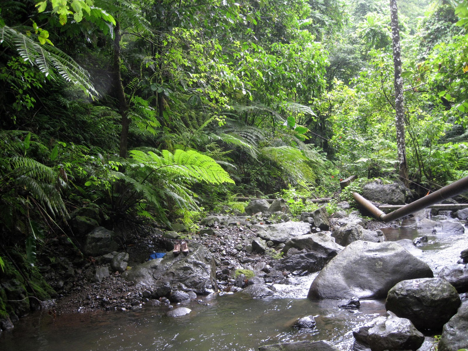
Saturday, in between rain squalls, I went to see Leone Falls, right near my home village. It's in the guidebooks, and marked on maps. They show a trail. But don't believe everything you read about Samoa. THEY LIE! There is indeed a Leone Falls, and I saw it, but very few others will. It's on private property (almost everything here is private family property). Turns out that the family owning it has a branch living right next door to me, so I got some instructions from young Spikey about how to get there and also see the place. It's at the end of a road that runs up into a valley. Way at the end is a house, and at the house are a half dozen Samoan dogs. These aren't cute little Fluffy pets, they're big and vicious, and came out snarling and barking when I parked & got out. So I stayed put until a resident came out; I explained why I was there, he recognized me from the neighborhood (he plays football outside my place) and was happy to show me. Not a long hike, but a trail that was rough, muddy, rocky, and hard to hike even with a guide who called off the dogs. He says they keep the dogs around just to keep tourists away. Seems to work; I wasn't going up there without him. Long ago the Navy cemented up the pool and ran pipes down to the village for water. The remnants of that work are still here, spoiling what would otherwise be a beautiful jungle sight. My guide says that kids still do come here to swim in the fresh water. Anyway, without further ado, here's a couple photos of Leone Falls; it's a sheer drop, maybe 30 – 40 feet, into a small pool:
 |
| Leone Falls, with pool below |
 |
| Path up to Leone Falls |
 |
| Leone Falls, wide view |
Later I drove down the coast again retracing my steps of the first weekend. But since everything is private, and it started raining heavily again, I backed up.
Sunday I went to climb the other mountain over Pago Pago harbor, Mt. Alava. It rained, lightly, most of the way. Except when it rained heavily, which it did all the way back down. I was the only person anywhere around. The trail up is run as part of the National Park here. It's a 4wd road, very rough, often very muddy and when not muddy it was steep & rocky. It runs, per the map, along the main ridge in the middle of this island through a tropical rain forest. Again, don't trust maps, THEY LIE! It does run near the ridge, but the jungle is so thick that it is little more than a passage blasted through; except for a few openings, you can't see out or down to either side. You can see jungle, lots of it, and there are birds of many kinds. My favorite was the Tropic bird, which is a pure white soaring bird with a long tail, looking much like a frigate bird but all white. They soar along, often below you back dropped by jungle canyons and ridges. Much too far away to get a good photo. After almost 2 hours climb, up & down & up & down I reached the summit and got some photos; here are a few:
 |
| Matafou, highest on island. A very difficult climb. |
 |
| Matalia Point, north side of the island. |
 |
| Pago Pago Harbor; Utulei (on right) where I work. |
 |
| Pago Pago village; tsunami blasted it last year. |
 |
| Mt Pioa (the Rainmaker) from Mt. Alava summit. |
 |
| Looking SW down the Tutuila coastline. |
At the summit are the remains of an old cable car tower and the local TV antenna. Years ago someone got the brilliant idea to run a cable up from the harbor area below, then use a cable car to haul tourists up the mountain. So they built it, and it didn't work well. Between breakdowns and few tourists, the thing just failed years ago. Whats left are the towers and pulleys, rusting away. Much like the Rainmaker Hotel, which was a big development a few decades back, down on the harbor near Pago Pago. They built this big modern hotel which slowly deteriorated over the years, and was then mismanaged into oblivion. It sits there still, holes in the roof, falling apart, unused. It's right near where I work, prime location on the waterfront. The tsunami last year did its share too, making it even worse. More pictures from Mt Alava:
 |
| Trail up to Mt. Alava. |
 |
| Trail down from Mt. Alava; note bamboo grove. |
 |
| National Park Service sign; my route. |
 |
| Made it! Arrival at the summit. |
 |
| Old, rusty cable car apparatus at the top. |
 |
| NPS sign about this island of Tutuila. |
Click the maps to open in a new tab, then enlarge it to read.
You can see much damage from the tsunami all around Pago Pago and the harbor. Everything in Pago itself that was near the harbor was wrecked, much of it still there, rotting away. Up the road it also wrecked among other things the old-style High Court building (they hold court now in a temporary building nearby), the Governor's offices and the National Park Info Center. We the American taxpayer have sent much money, millions, over here to Am Sam as tsunami relief. Lots of it just isn't there anymore. No one seems to know where it went, but everyone knows they need more of it.
Last item: here's a short video of a small waterfall en route up to Mt. Alava. Perhaps the water and jungle sounds will be soothing:
Next up: Christmas, American Samoan style.
Welcome home Lisa!!!


Hi Dad! Thanks for letting me cruise around in your brand new car all winter long! I'll be careful and NEVER speed. :)
ReplyDeleteThere is a good video on the Mount Alava hike called, "American Samoa Rainforest Hike by BusyCorner channel.
ReplyDeleteJW
Awesome post, Rick. Can't wait to see some of this, despite your descriptions!!!
ReplyDeleteSuzy